Redwood River current could become speedier as snow melts
Every year, the Minnesota Department of Natural Resources (DNR) temporarily shuts down state forest roads and trails that may not be firm enough to support vehicle traffic without causing damage. Depending on weather conditions, the temporary closures could remain in effect until sometime in May.
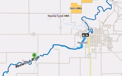
At the moment, there are no roads or trails being shut down by the DNR in KLGR-land, but the agency did note that conditions on the Redwood River, which passes through Redwood and Lyon Counties, could worsen. The Redwood River originates near Ruthton, among the wind farms high atop the Buffalo Ridge. The elevation at its source makes the Redwood one of the flashiest rivers in the state.
As of 8:45 a.m. Friday, the DNR rated the level of the Redwood River between Marshall and Redwood Falls as “Medium”. At “very high” water levels, conditions are dangerous and river travel should not be attempted.
The most canoeable portion of the river begins near Marshall and ends at Lake Redwood in Redwood Falls. Those who wish to continue on to the Minnesota River will have to portage around the Lake Redwood Dam under the Highway 19 Bridge, re-entering in Alexander Ramsey Park.
Related Content